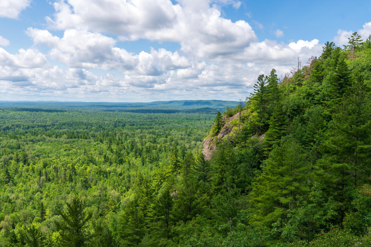
Norwich Bluff's remote location offers for epic views for those willing to go the extra mile.
Getting There
It’s tough to describe where Norwich Bluff is because it isn’t close to anything! To get there from Houghton, head south on M-26 until you reach the M-26 & M-38 junction near Greenland. Follow M-38 west towards Ontonagon until you reach this quiet town on the Lake Superior shoreline. Keep straight on M-64 over the Ontonagon River until you see signs for Norwich Road on your left after 1.6 miles. Head south on Norwich Road for 12.8 miles.
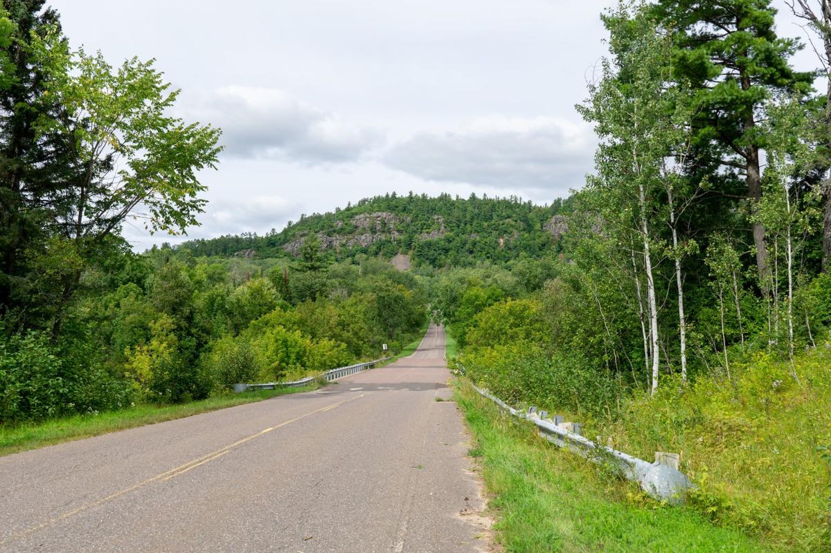
Peaceful nature surrounds the quiet stretch of Norwich Road.
There are two access points for Norwich Bluff. Your first option is a small parking area on your right, just before reaching Forest Road 630. This is a convenient trailhead for the North Country Trail. The most direct access option is a parking area right under the bluff itself which serves as the trailhead for the Norwich Mine Historic Site. Keep on Norwich Road for 1.9 miles beyond FR630 until you see the pull-off on your left.
North Country Trail: A Hidden Hiking Gem
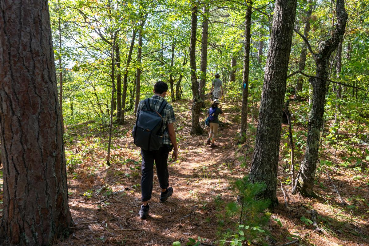
Stretch your legs and soak up sun-soaked northwoods landscapes on the NCT.
If you’re looking for a rewarding and somewhat challenging 5-mile round-trip day hike on the North Country Trail (NCT), the trip up to Norwich Bluff should be on your list. This National Scenic Trail stretches from North Dakota to Vermont, with over 1,100 miles right here in Michigan. The NCT across the Western U.P. is some of the most scenic and varied along its entire 4,800 mile length.
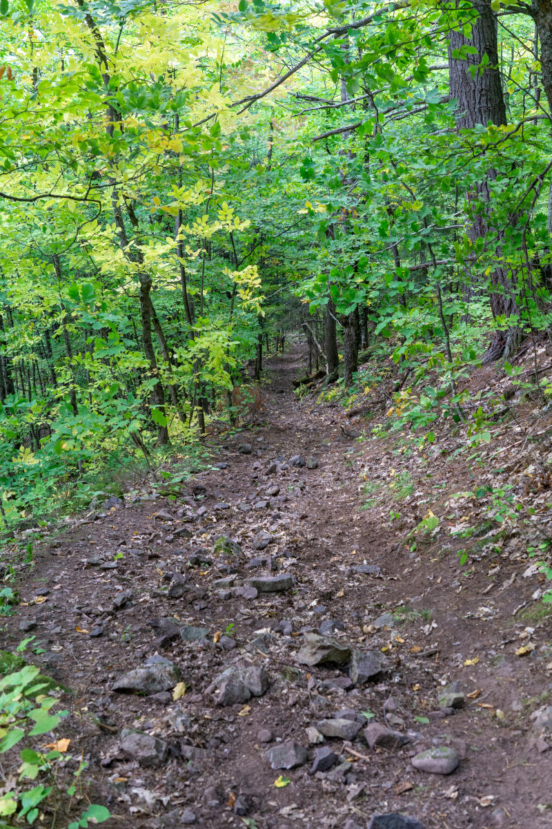
From the parking area near Forest Road 630, head east across the road towards the bluff. The trail has a short approach before the thigh-busting terrain kicks in. From the road to the first big view, you’ll rise over 300’ in elevation in under a mile. That’s fairly steep for these parts but the hike is totally worth it. The forests are full of mature maples, oaks, hemlocks, and other long-lived species. Breaking up the forest are numerous gullies that may have small streams in them depending on how much it’s rained recently. These rocky creeks add to the tranquility of the forest but also increase the number of ups-and-downs on the trail.
Trails in here can be a workout even for experienced hikers. Do your stretches and wear the good hiking boots!
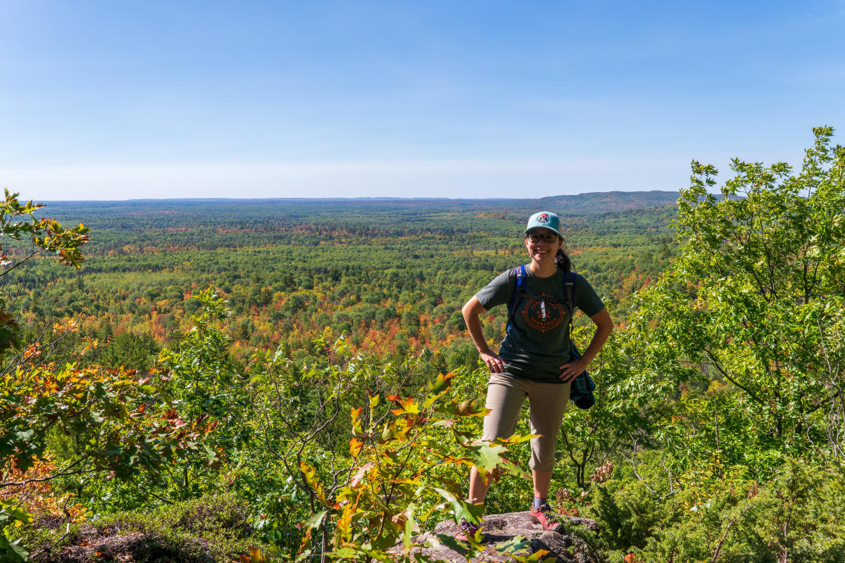
Eventually you’ll make it to the upper portions of the bluff where the NCT levels off and rewards you with enormous views out over the landscape. The first of many viewpoints looks west and north. From here you can catch a glimpse of Lake Superior and the Porcupine Mountains far in the distance. Aside from a few small cabins in the foreground, almost the entire landscape is undeveloped. And with little traffic on Norwich Road or the NCT, you’ll rarely hear another soul out here.
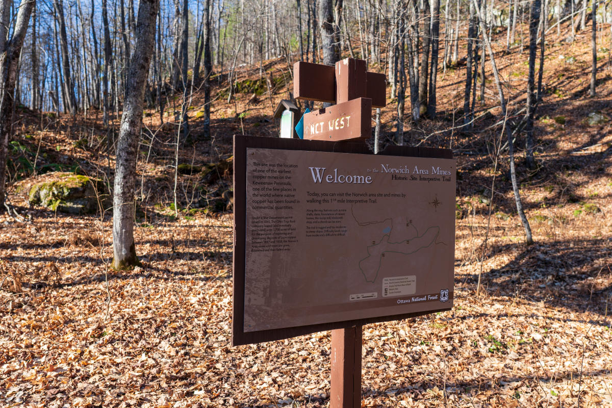
Keep an eye out for posted signs with guides to the historic copper mining sites within Norwich area.
Continue for a total of two miles until you reach a junction with the Norwich Bluff Interpretive Trail. Along the way, you’ll find more panoramic viewpoints. Words really can’t describe how beautiful these views are. Atop the craggy edges of big cliffs, you’re treated to some of the best that the Ottawa National Forest offers. For a guy that’s explored a huge chunk of it, that’s saying something!

Copper Mining History on Full Display
Copper mining on Norwich Bluff began in the mid-1840s by the American Mining Company. Exploration expanded in the 1850s with the addition of the adjacent Windsor Mine. The Norwich and Windsor combined in the 1860s before shutting down after producing just under 1 million pounds of copper. Not a bad haul considering most mines in this region ended in failure! Later in the 1890s and early 1900s the Essex, Copper Crown, and Cass Copper companies all tried their hand at reopening the old Norwich mine. None found success and the bluff has remained quiet ever since.
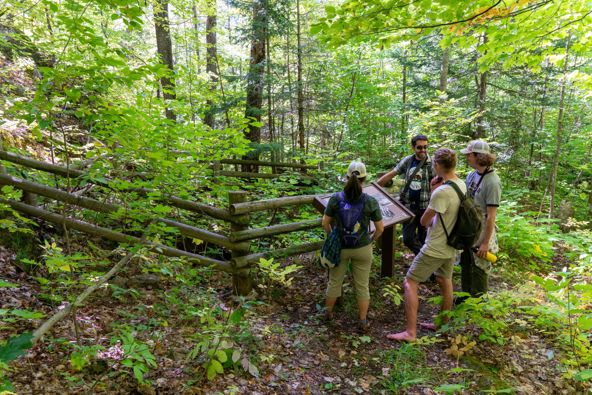
History buffs will appreciate the posted interpretive signs about the area's copper mining history. A place to reflect (and catch your breath.)
The Norwich Bluff Interpretive Trail is a great way to truly get a feel for how difficult mining was in the early days of the Copper Country. The trail creates a 1.1 mile loop with the NCT and has several educational signs along the way that describe how the landscape once looked. Traces of old dams, foundations, and entire townsites can still be found in the hilly terrain. Most notably though are the gated adits and mine shafts. A few can be found alongside the trail and make for a unique experience as you hike around.
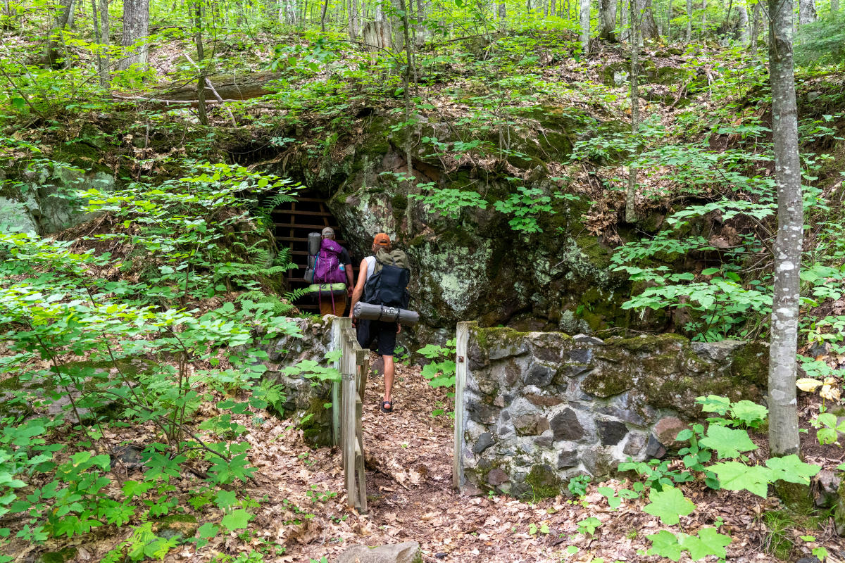
Though closed for safety, you can peer into the mysterious depths of the Norwich mineshafts.
There are two ways to access the Interpretive Trail, which is primarily located along the top of the bluff. The first is to follow the NCT (described above). The second is to park at the Norwich Mine Historic Site parking lot. Follow the 0.6 mile trail along the base of the bluff until you find the Mule Trail on your left. You may not like what I’m about to tell you, but… it goes more or less straight up the bluff! No wonder miners used pack animals to do the heavy lifting for them. Take your time on this challenging, rocky trail. Although there are nice views from the Interpretive Trail, you will miss out on others found along the longer NCT approach.
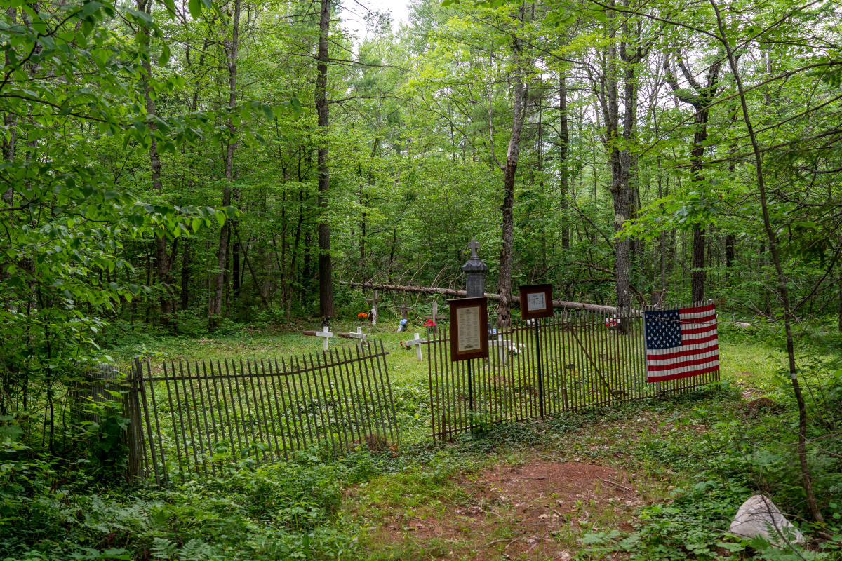
As a consolation prize for hiking straight up the bluff, be on the lookout for a side trip to the historic cemetery along the bottom of the hillside. There are still a few well-maintained plots in the woods worth checking out.
Know Before You Go
A prepared hiker is a happy hiker. Norwich Bluff views are worth the effort in any season!
The terrain at Norwich Bluff can be quite difficult in places. Be sure to wear sturdy footwear, bring plenty of snacks and water, and dress in layers in case you get too warm (or stay out later than planned). Cell service may be found on top of the bluff but is not guaranteed deeper in the forest. Always let someone know where you are going and be sure to download or bring a paper map with you. Rescue here would not be quick so watch your step.
Please be respectful of the historic resources you find during your visit. The mines have been gated for a reason: entering historic mines can be dangerous and put the remaining bat populations at risk. Admire these locations from the outside. If you discover a historic artifact, leave it in place for others to appreciate and research. Metal detecting is not permitted at Norwich Bluff.
Recreate Responsibly: Keeping a watchful eye on your interactions and impacts on the wild Keweenaw nature, remaining historical elements, and your fellow humans is an important aspect of enjoying the Keweenaw. Together we can Leave no Trace to ensure these locations remain a beautiful and safe experience for all.