Your browser is not supported for this experience.
We recommend using Chrome, Firefox, Edge, or Safari.
COPPER COUNTRY TRAIL NATIONAL BYWAY
A visit to the Keweenaw is not complete without a scenic drive through our historic communities and wilderness areas. Mining heritage can be found everywhere thanks to generations of development spurred on by the rich copper ore found deep beneath our feet. Although the mines are no longer operating, our communities have held onto this history and continue to celebrate its impact on our region through intentional preservation efforts. Nowhere is this history better on display than along the Copper Country Trail National Byway.
The Copper Country Trail National Byway follows US-41 from the Portage Lake Lift Bridge all the way to Copper Harbor, a 47-mile stretch that forms the backbone of the Keweenaw. This important corridor played a major role in our mining story for well over a century. Today it may feel like simply the fastest route from Point A to Point B, but if you dig a little deeper you’ll discover an exciting number of fascinating pit-stops to explore during your visit.
Buckle up for adventure because the Copper Country Trail National Byway has you covered!
WHAT IS THE COPPER COUNTRY TRAIL NATIONAL BYWAY?
The Copper Country Trail National Byway is one of 184 Federally designated National Scenic Byways and All-American Roads, all of which tell a story about our nation’s development, history, or scenic qualities. The Copper Country Trail is one of just two National Byways in Michigan and the only one in the U.P. The primary corridor follows US-41 through the communities of Hancock, Calumet, Mohawk, and Copper Harbor, with several spurs including M-203 and M-26. As you drive (or bike!) along these scenic roadways, you’ll come face-to-face with a variety of historic sites, museums, and other attractions that all relate to our copper mining story.
You can spend anywhere from an hour or two all the way to multiple days exploring the Copper Country Trail. Find some ideas below of how to make the most of your visit to this historic route.
THE HISTORY BEHIND THE COPPER COUNTRY TRAIL NATIONAL BYWAY
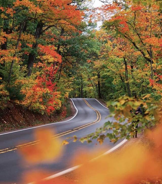
 The Copper Country Trail National Byway began life as one of the first designated Michigan State Heritage Routes in 1994. Originally encompassing the scenic, tree-covered portion of US-41 from Phoenix to Copper Harbor (one of the top fall-color drives in the country!), the Heritage Route was extended all the way to the Lift Bridge in 2004. In 2005, a coalition of partners from across the Keweenaw successfully petitioned the National Scenic Byways program for national recognition. Without our successful copper mining boom, the nation’s rapid industrialization would not have been possible. The Copper Country Trail, which follows that history from lake to forest, is the perfect venue to learn about this important chapter in our national history.
Defined by its historic significance, Copper Country Trail National Byway highlights the triumphs and tragedies associated with copper mining. The 47-mile stretch of US-41 from Houghton to Copper Harbor follows the copper lode that lies deep underground and is the basis of our exciting and turbulent history.
1841 was a pivotal year for the Copper Country. That’s when Douglass Houghton, Michigan’s first state geologist, filed surveys and reports demonstrating an abundance of copper in the region.
The Calumet and Hecla Mining Company (C&H) and the Quincy Mining Company came to dominate the Michigan copper industry. From 1867-1882, the companies represented the greatest longevity, production and technical innovation in the world. During this time, C&H alone accounted for more than half of the nation’s copper. As late as 1882, C&H accounted for 63 percent of the total U.S. copper production. At their height, the mining companies constructed public buildings and housing for their employees and lavish residences for themselves that reflected the Copper Country’s growing prosperity.
As the Copper Country rose to international fame during this time immigrants poured in from all over the world. Ethnic groups included Cornish, Italian, Finnish, German, French Canadian, Irish and many more. These new Copper Country residents built the facilities that eased life in a new world. Bars, government buildings, fraternity halls, stores, were built. Because of this, enduring communities were built throughout the Keweenaw that can still be seen today.
As the nation shifted from the roaring 1920s to the depressed 1930s, so did mining activity in the Copper Country. The decline of copper mining caused an out-migration over the following decades and C & H closed down their last mine in 1968; it was the last native copper mine in the Keweenaw.
EXPLORE THE COPPER COUNTRY TRAIL NATIONAL BYWAY
US-41: Hancock & the Quincy Mining Empire
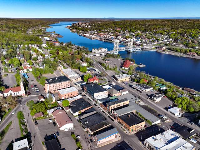
Your journey along the Copper Country Trail National Byway begins at the historic Portage Lake Lift Bridge, an engineering marvel and the heaviest double-decker lift bridge in the world. Built at the tail-end of the Keweenaw’s copper mining era, this mammoth structure once carried trains on the lower deck and vehicles above. US-41 quickly reaches downtown Hancock, full of stunning historic buildings, each with their own unique story to tell. Explore local shops, restaurants, and historic sites along this beautiful walkable corridor before you carry on north.
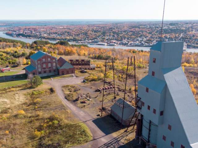
Atop the hill above Hancock stands the pride of the Keweenaw: the Quincy No. 2 Shaft-Rockhouse. It’s hard to miss! What you see above ground is just the tip of the iceberg. This mineshaft once descended over 9,000’ at an angle to reach copper ore buried deep underground, making it the deepest mine shaft in the world at the time. Surrounding the mighty No. 2 are a collection of ruins and the equally impressive Hoist House, itself the largest steam hoist in the world. Tours of this impressive facility, both above and below ground, are available through the Quincy Mine Hoist Association.
Before you continue north on US-41, consider a quick detour on M-26 to the community of Ripley. Here you’ll find the Quincy Smelter, the last remaining copper smelter from this era in the world. The expansive site has a ton to see and was the last stop for over one billion(!) pounds of copper before it was shipped out of the Keweenaw.
US-41: Calumet & Laurium’s Splendor
There’s no argument that the heart of the Keweenaw’s copper boom was Calumet. Evidence of Calumet’s (and its neighbor Laurium) grandeur is everywhere you look. Some of the most beautiful architecture in the Upper Peninsula can be found in this now-sleepy community. Historic homes built by titans of industry, like the Laurium Manor Inn, dot the side streets. Remnants of the mining era abound.
Calumet is headquarters for the Keweenaw National Historical Park and should be on your must-see spots along the Copper Country Trail. They’ve got an immersive museum that showcases many of the stories of the mining heyday. It’s not the only museum in town though! Find them and more in one of our itineraries for a self-guided adventure through Calumet here.
Other must-see sights in Calumet include the historic Calumet Theatre where live shows pack a punch, Copper Country Firefighters Museum (great for kids!), and the beautiful Shute’s 1890 Saloon.
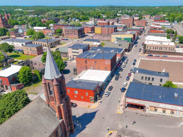
US-41: The Northern Reaches of Mohawk, Phoenix, Central, & Delaware
The forest begins to draw closer the further north your drive along US-41. The last large community (by Keweenaw standards) is Mohawk along US-41. Fill up on gas now before heading north into the backcountry! You’ll find a few great little restaurants here as well, including Slim’s Cafe and the Mohawk Superette, both of which have some of the top pasties in the Keweenaw.
Further up the winding road you’ll first encounter the ghost town of Phoenix, which today is home to a single general store, the historic Bammert Blacksmith shop, and the beautiful Phoenix Church. Not long after that, the mining location of Central comes into view. Several old homes can be found at this long-shuttered mining location, as well as the unique Methodist Epispical Church which is home to the annual Central Reunion. A small visitor’s center offers seasonal information for travelers to this tiny corner of the Keweenaw.
Finally, for those looking for a self-guided underground mine tour, look no further than Delaware Mine. Both the underground and aboveground tours are excellent activities that are sure to impress everyone in your family. Little remains of the townsite that once supported Delaware Mine, leaving one to search the forests and tunnels for clues to the past.
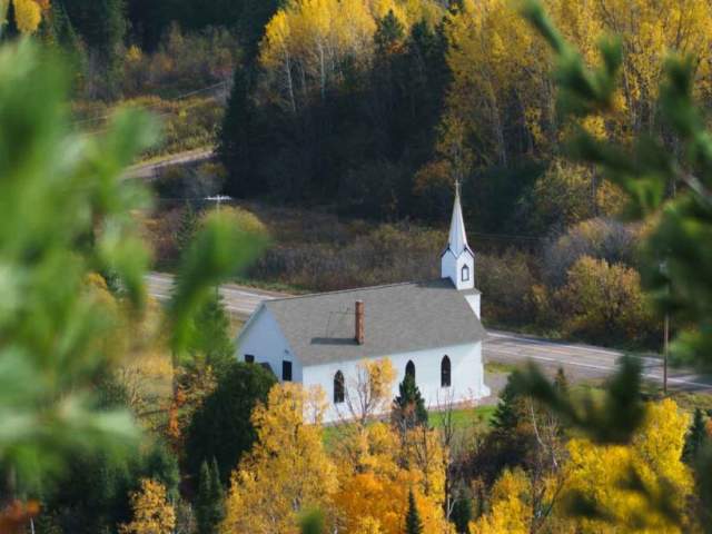
Bonus Adventures: McLain & Lac La Belle
At one point the entire Keweenaw was dedicated to supporting the copper mines found along the US-41 corridor. Farms, ports, timber operations, and other supporting industries helped ensure the mines thrived, many of which are still evident today along the Copper Country Trail’s primary spurs. M-203, which stretches from Hancock to Calumet the long way, pays a visit to McLain State Park. Today this scenic site is known for camping and beaches, but during the mining era the area served as the northern terminus of the Portage Canal. The lighthouse at the end of the breakwater once guided in the largest lake freighters as they brought in coal and hauled away copper ore.
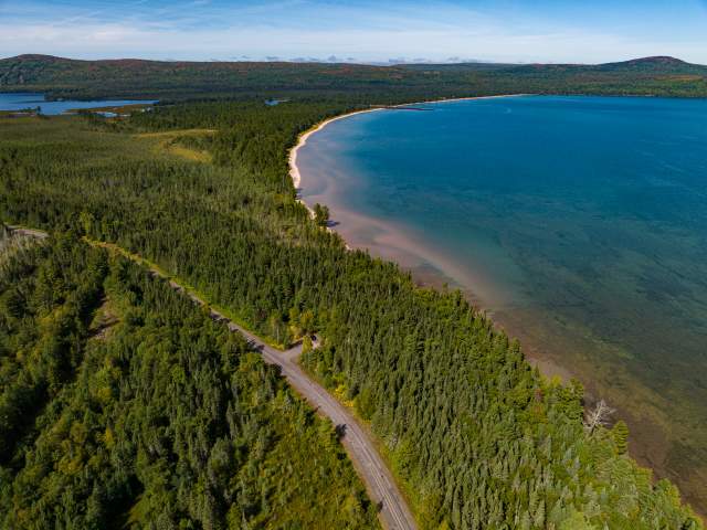
Similarly, the Gay-Lac La Belle spur takes you far to the east of most Keweenaw communities. In the community of Gay you’ll discover the ruins of a massive stamp mill that served several mines in the area over the years. Further up the road in Lac La Belle, several historic sites can be seen, including the privately owned Mendota Lighthouse, adjacent canal, and a small stamp mill near Haven Falls. Today the area is best known for the white sand beaches at Bete Grise and the extreme backcountry skiing at Mount Bohemia.
No matter the mode of transportation, the Keweenaw Peninsula is filled with breathtaking scenery all year round. But there’s something freeing about hitting…
