The Hike
The hike to Hungarian Falls is fairly mild and should not be a problem for anyone with moderate hiking abilities. It can become more difficult depending on how much scrambling you want to do, with great rewards for those willing to go the extra distance. Don’t feel like the extra effort is required though, because almost everything is readily accessible from the main paths!
Upper Falls
From Golf Course Road, take the rough road into the forest. Washouts over the years have made this area quite bumpy in places. Follow the road until you hit a T-intersection. Time to make a choice! Head to the upper falls and dam first, or to the more scenic lower drops? I usually prefer to head upstream first.
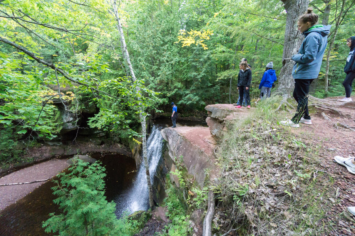
Take a right at the intersection and almost immediately take a slight left onto a narrow pathway heading towards Dover Creek ahead. This will quickly lead you to the historic dam (more on that later). The spillway doesn’t count as a waterfall, so don’t be fooled into thinking you’ve seen the upper falls yet. Head up the hill and check out the small reservoir, then follow the trail up along the edge of the gorge. There are plenty of big roots along the trail in this area so watch your step.
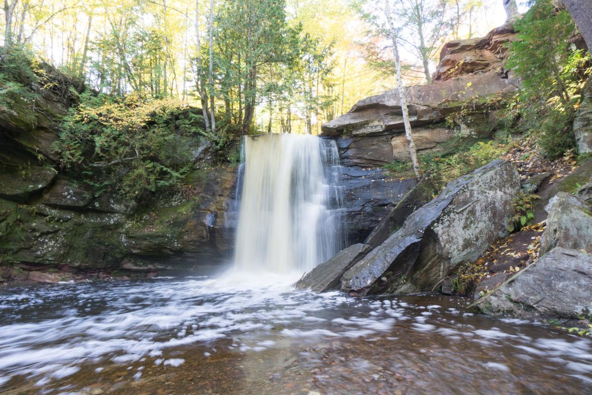
Eventually you’ll reach an option to take a route to the top of the falls or the bottom. The top route is easier, while the bottom offers the best views of the upper falls. Your pick! The scramble down to the creek can be steep so be careful. The tight gorge walls at the bottom perfectly frame the rugged upper falls as it crashes over the precipice onto the boulders below. It’s equally scenic from above and worth viewing from both angles.
Upper Falls
Middle and Lower Falls
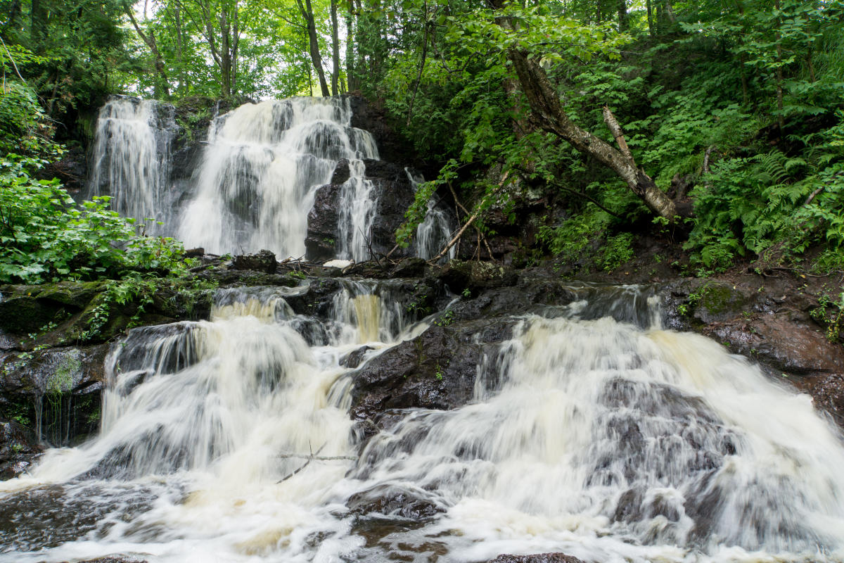
To reach the middle and lower falls, retrace your steps to the T-intersection from before. Head downstream on the well-worn path that parallels the creek. After a few hundred yards, you’ll quickly reach the middle falls. The middle Hungarian Falls are a sight to behold and one of the most scenic waterfalls in the entire U.P.! The river drops straight off a sandstone ledge into a pool below and should not be missed. For the best views you’ll need to see it from below. A challenging rocky path can be found just past the falls, or you can continue to the lower falls and work your way back upstream along informal footpaths (this requires crossing the creek).
Middle Falls
Just downstream from the middle falls is the final stop on your tour. Follow the path downhill a short distance until the valley opens up before you. It’s hard to describe just how immense the view is, so we’ll let the photos do the talking!
The lower Hungarian Falls crash into the depths below and are barely visible from the top. Be extremely careful near this cliff! Most people are satisfied with the huge views towards Torch Lake and the roar of the river as it rushes over the edge. Even this seasoned adventurer passes on trying to get a closer view of it.
Once you’ve gotten your fill of the scenery, backtrack up the hill and take the access road back to your vehicle. Now you’ve seen it all!
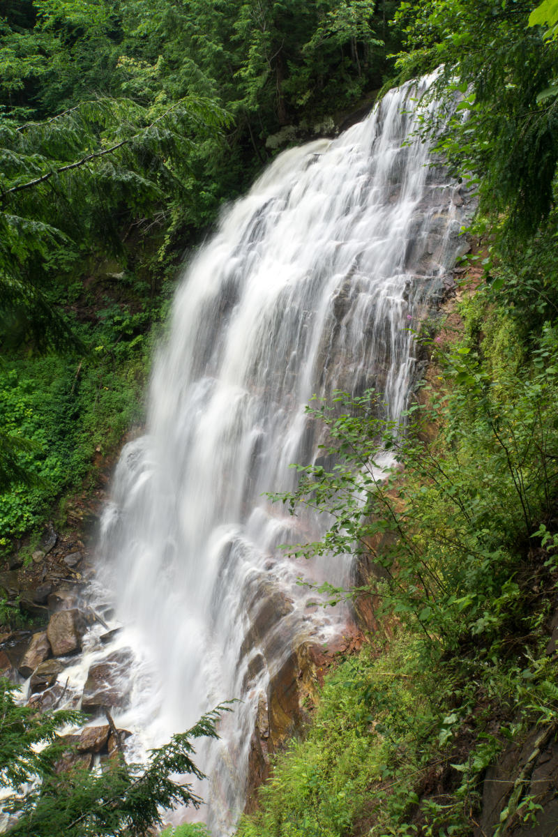
Lower falls
Hungarian Falls History
Like much of the Keweenaw, this area was heavily utilized during the copper mining era. Unlike in many areas where rivers were dammed for use in steam boilers, the small reservoir at the top of the gorge was used for fire suppression purposes. To put out potentially catastrophic blazes at the turn of the 20th century, companies like Calumet & Hecla traded one risk for another: in the event of a fire, they’d throw open a valve and unleash the reservoir’s waters on their mill below! Recovering from a literal flood was a better alternative than letting it burn to the ground.
After the mines and mills closed, the reservoir was used to supply water to the community’s fire hydrant network. Eventually this became redundant, and the reservoir was no longer needed. In late 2012, the uppermost falls and dam were put up for sale. Alarmed at the prospect of losing a popular natural attraction, local citizens worked with the Keweenaw Land Trust to purchase 10 acres of land to protect the upper parts of the gorge. I had just started working at KLT at the time and was tasked with helping to fundraise for this important project. The response was incredible, with hundreds of people donating to protect this special place. Nice work everyone!
The bulk of the gorge is owned by the Michigan Department of Natural Resources. All of these waterfalls are open to the public free of charge and will hopefully stay that way forever.
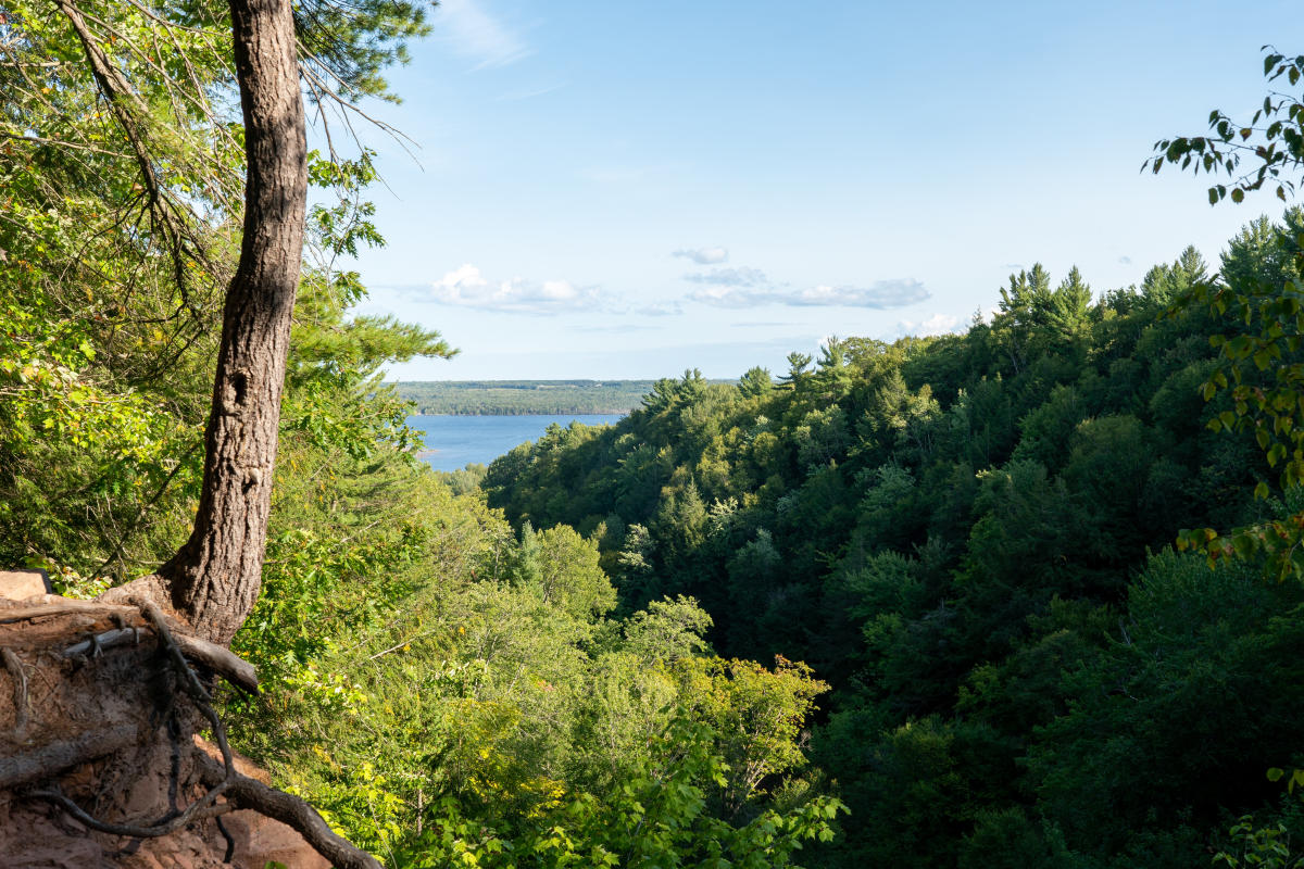 A view from the top of the Lower Falls looking down toward Torch Lake

Interested in updates, travel tips and quirky information about the Keweenaw? Just sign up for the Keweenaw Explorer, our monthly e-newsletter. Complete the form…
Things to Know
Although this special place is open to the public, please be respectful of other visitors and practice Leave No Trace. Fires, camping, and littering are forbidden. Pack out all of your trash and help keep this area beautiful! Water, snacks, and a bag for any extra layers would be helpful. A camera is a must. There’s usually decent cell service up here, although it may cut out if you go too deep in the lower parts of the gorge.
Note: in winter Golf Course Road is not plowed along the steepest stretches of the road. It is easier to approach the falls from the upper side, adding roughly 0.3 miles on either end of your snowshoeing adventure.