The Case for Kuparisaari – Copper Island
According to most geographic records with any authority, Michigan’s largest island is Isle Royale. Located in Lake Superior and coming in at approximately 205 square miles in area, this national park holds the official title. The 45-mile long island and its collection of 450 smaller islands attracts outdoor enthusiasts from across the globe interested in its pristine trails and Northwoods wildlife.
But located due south by approximately 55 miles is the coast of Kuparisaari, which translates to “Copper Island” in English. Kuparisaari was the Finnish name of the northern half of Michigan’s Keweenaw Peninsula bestowed by the immigrants who ventured to remote region in the mid-1800s in search of copper ore. And while the copper rush came to an end nearly 60 years ago, the “island” designation still seems apt.
According to Dr. Don Lafreniere, Associate Professor of Geography and Geographic Information Systems at Michigan Technological University, the verdict is clear cut. “Yes, it is technically, and absolutely, an island,” Lafreniere explained. “According to the Oxford Essential Geographical Dictionary, an island is defined as ‘a landmass that is totally surrounded by water and is a minimum of 100 feet long in any direction and a minimum of 50 feet from the main shoreline’. This distinction is to overcome small changes to rivers such as oxbows and such.”
As the Google Earth image below shows, the northern portion of the Keweenaw Peninsula is surrounded by water and is only connected to the “mainland” via the Portage Lake Lift Bridge. With Lake Superior to north, east, and west, and The Keweenaw Waterway to the south, Kuparisaari appears to meet the technical definition of an island. And while not a precise measurement, the outline below puts the area of Copper Island at approximately 560 square miles—more than double the size of Isle Royale.
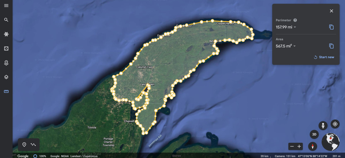 A screen grab from Google Earth showing a boundary of "Copper Island".
A Brief History of the Keweenaw Waterway
So why isn’t Kuparisaari fully recognized as Michigan’s largest island? According to Lafreniere, “Some will argue that it is an unofficial island because the north entry canal is man-made, but that does not disqualify it from being an island.”
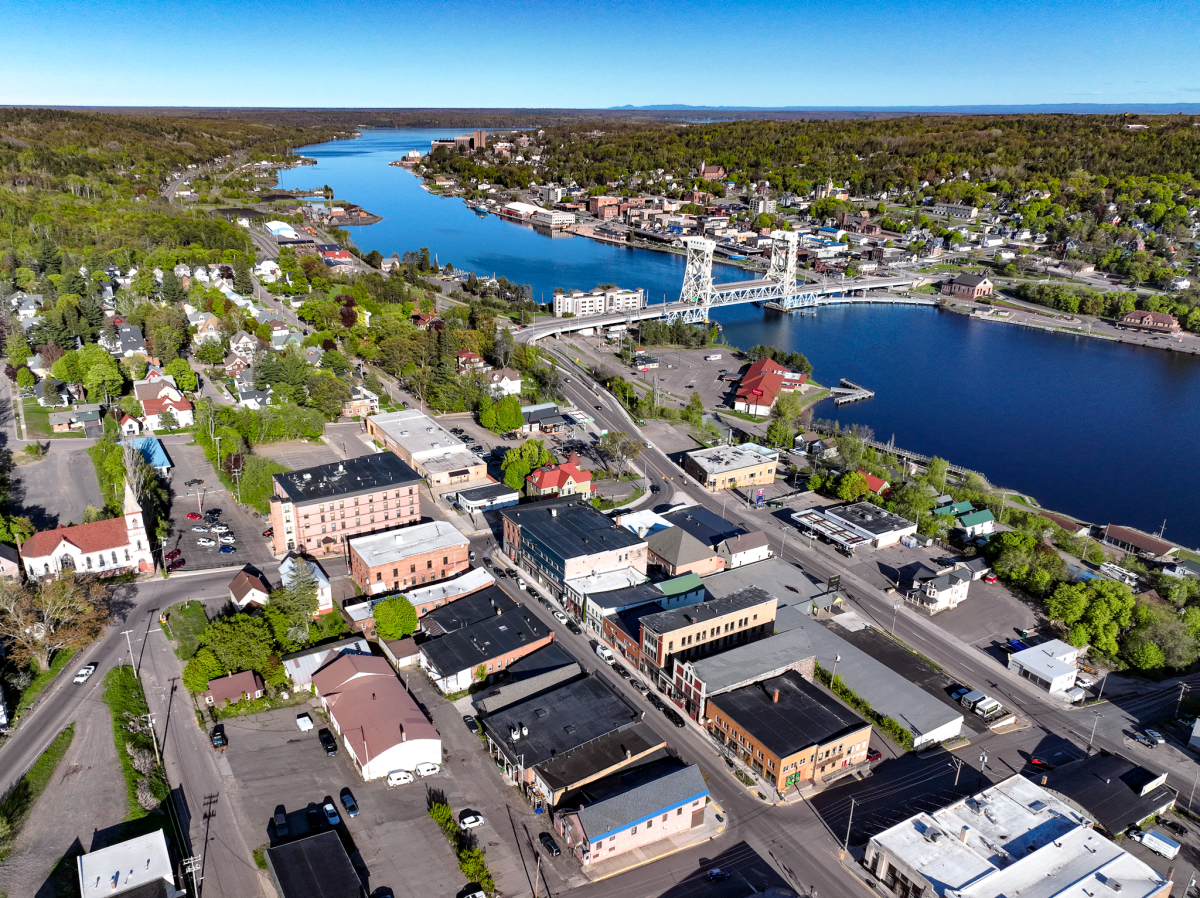
Today, the Keweenaw Waterway cuts through the Keweenaw Peninsula and separates the northern half from the rest of the Upper Peninsula. Comprised of several linked bodies of water, including Portage Canal, Torch Lake, and Portage Lake, the waterway offers access to Lake Superior from both upper and lower entries.
The Waterway, as we know it, was augmented by several separate efforts beginning in 1860. During the second half of the 19th century, the region’s booming copper industry created an appetite for more efficient maritime transportation routes to get the red metal to market quicker and cheaper. The creation of the Portage Lake Ship Canal, which linked Keweenaw Bay on the eastern side of the Keweenaw Peninsula with Portage Lake, was opened in June 1860. It was constructed by several local individuals, who later organized the Portage Lake and River Improvement Canal. In 1864, the Portage Lake & Lake Superior Company was formed, facilitated by the U.S. Government and several mining companies, to connect Portage Lake to Lake Superior on the western side of the Keweenaw Peninsula. Construction began in 1868. While financial mismanagement led that company to go bankrupt, a second effort by the Lake Superior Ship, Canal, Railway and Iron Company eventually completed the project in 1874. In 1890, the U.S. Government purchased both the eastern and western canals for a sum of $350,000.
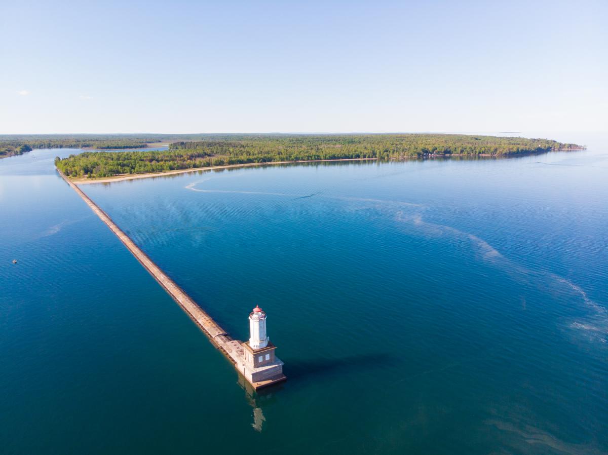 A view of the Keweenaw Waterway's lower entry near White City.
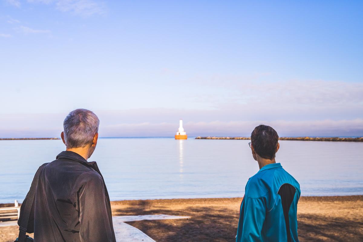 A view of the Keweenaw Waterway's Upper Entry at McLain State Park.
The Final Verdict
It’s hard to argue against Dr. LaFreniere’s assessment, but we at Visit Keweenaw are admittedly a bit bias. We’d love to see Kuparisaari take its rightful place atop the storied annals of Michigan’s most beloved islands. But what do you think? Should a petition campaign to the U.S. Board on Geographic Names commence?
 The only land access to Copper Island is across the Portage Lake Lift Bridge which connects the cities of Houghton and Hancock, MI.
Sources
Bowling Green State University. GLMS 18 - Portage and Lake Superior Canals Collection https://lib.bgsu.edu/finding_aids/items/show/732.