Michigan’s northernmost town of Copper Harbor is a beautiful destination that is well-known for its outdoor recreation, small town charm, and incredible views of Lake Superior. Not only is it a great place to unplug and unwind, but it is also a historically significant destination in Michigan’s Upper Peninsula. We’ve put together this guide to help you explore this rich history next time you visit Copper Harbor.
The Landscape
Copper Harbor is known as an incredible rugged wilderness – a landscape created by ancient volcanic and glacial activity. Rugged basalt shoreline, mountainous peaks, Lake Superior, and vast forest make this place a land of wealth for many reasons. Rich in natural resources, the history of Copper Harbor includes copper mining, logging, commercial fishing, and abundant recreation.
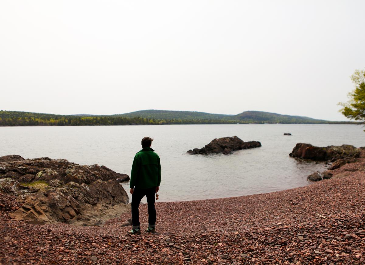
Copper Harbor is a scenic destination with rugged shoreline and vast wilderness to explore.
In Copper Harbor, you can walk across basalt formations that are over a billion years old, hike through trees that are hundreds of years old, and visit historic attractions dating as far back as 1844. It’s easy to imagine the lives of the people who inhabited this region before us and their impact on the environment that we experience today. As you explore the Copper Harbor area, remember to Leave No Trace and Recreate Responsibly. Keep your impact on this environment as minimal as possible so this incredible destination remains magical for generations to come.
Ancient Copper Mining
The history of Copper Harbor dates back farther than one might imagine. Evidence suggests that an ancient population lived in the area some 7,000 years ago, digging pits to find glacial float copper hiding beneath the surface of the Earth.
Long before European settlers inhabited the area in search of this highly sought after “red metal,” the Ojibwe people inhabited the area. The Ojibwe people used copper to make a variety of items for trade. These items included fabulous jewelry, beads, knives, awls, fishing hooks, and more. Handmade copper items were widely traded and have been found all over America.
Fort Wilkins – 1844
In 1840, Douglass Houghton, state geologist of Michigan published a report on the Upper Peninsula as part of the state geological surveys he was conducting. His description of the Keweenaw’s rich copper deposits piqued the interest of investors and entrepreneurs from around the country. In 1842, the Ojibwe signed the Treaty of La Pointe ceding their copper-rich lands to the United States, and soon after, a mad rush to the Keweenaw began.
As mines began to pop up around the Keweenaw, tens of thousands of European immigrants moved to the region chasing after the newly famous “red metal.” As the landscape of the Keweenaw transformed from one of vast untouched wilderness to something much more industrial, the culture of the area also changed. What was once the isolated home of a small population of Ojibwe people became flooded with different languages, new ideas, increased development, and a faster pace of life.
With rapid change and increased interest in the region's rich mineral deposits, the U.S. Government became concerned about possible disorder and violence. In 1844, under the discretion of the U.S. Secretary of War, William Wilkins, the fort was established.
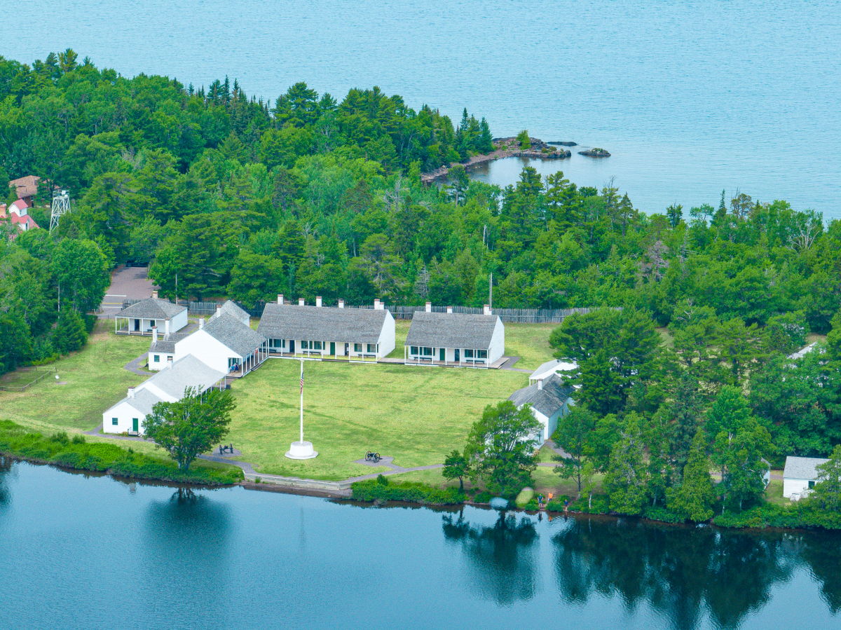
Fort Wilkins Historic State Park includes 12 of the original buildings from the time the fort was established in 1844.
Soldiers stationed at Fort Wilkins were intended to help local law enforcement officers keep peace between immigrant mine workers and the Ojibwe tribes in the area. The fort only operated for a couple short years, as it was quickly deemed unnecessary because little conflict occurred.
In 1846, the troops stationed at the fort were sent to assist with the Mexican – American War. The fort passed through the hands of a few different individuals and was later reoccupied from 1867-1870 when the U.S. Army needed a place for men to serve out their enlistments following the American-Civil War. The Army abandoned the fort entirely in 1870, and in 1923 the fort and the Copper Harbor Lighthouse became a Michigan State Park.
Today, the park includes 19 buildings (12 of them original), a modern campground, trails, and a living history program provided by the Michigan History Center. The living history program runs through the summer months and offers visitors a glimpse at what life was like on the northern frontier during the mid-1800's. The fort serves as a time capsule that dates back to an important period of time in Copper Country history.
Astor Shipwreck – 1844
The eruption of the copper mining industry also led to increased demand for navigation on Lake Superior. Copper Harbor became an important hub for shipping during this time. Ships arriving in the area delivered essential supplies, transported people, and exported copper that was mined in the region.
The John Jacob Astor was one of the earliest ships that delivered supplies to Copper Harbor. Built in 1835, the Astor was a schooner-style ship that made an important navigational discovery during its maiden voyage from Sault Ste. Marie. Captain Charles C. Stannard discovered Stannard Rock – a substantial underwater reef located 24 miles from the nearest land. With depths as low as 4 feet, this reef presented a serious hazard to ships navigating Lake Superior. Stannard Rock Lighthouse was later built atop the reef to prevent ships from running into it.
On September 21, 1844, the Astor was hauling supplies to the troops stationed at Fort Wilkins. It had just finished unloading supplies, when a change in wind direction caused the Astor to drag her anchor and eventually crash on the rocks near the Fort Wilkins dock. No lives were lost in the shipwreck, but the ship itself never left the frigid waters of Copper Harbor. The remains of the Astor are now broken up and scattered in a wreckage field between the Fort Wilkins dock and Copper Harbor Lighthouse.
Visitors can view the wreckage from the Fort Wilkins dock where historical markers have been placed to share the history of this famous Lake Superior shipwreck. The Astor shipwreck is part of the Keweenaw Underwater Preserve, and experienced divers can follow an underwater trail to view the scattered artifacts that were left behind.
Hays Point
Hays Point is the location of the Copper Harbor Lighthouse. Extending into Lake Superior, this strip of land was named after John Hays of the Pittsburgh and Boston Mining Company. The company started excavating pits on the point (and at Fort Wilkins) in 1844, just four years after Douglass Houghton published his report that prompted the Keweenaw Copper Rush. This mining company also owned the Cliff Mine and was the first serious mining operation in the Keweenaw Peninsula region. Visitors can view the remaining pits dug when visiting Fort Wilkins Historic State Park. If you visit Hays Point (we’ll get to how to do that soon), see if you can locate the copper vein stretching into Lake Superior on the rocky shoreline looking north.
Copper Harbor Lighthouse – 1848
As the copper mining industry took off in the Keweenaw, the U.S. Government saw a need for an aid to navigation in the Copper Harbor area. Ships were bringing in essential supplies (and people), as well as moving copper out of the region for use across the United States during the electrical revolution.
Funding to build a light on Hays Point was approved in 1847, and the first tower was constructed in 1848. This was not the current structure that you see today. It was a brick tower with a neighboring lightkeeper’s house. The lighthouse that you see today was built in 1866 using the stones from the original tower as the foundation.
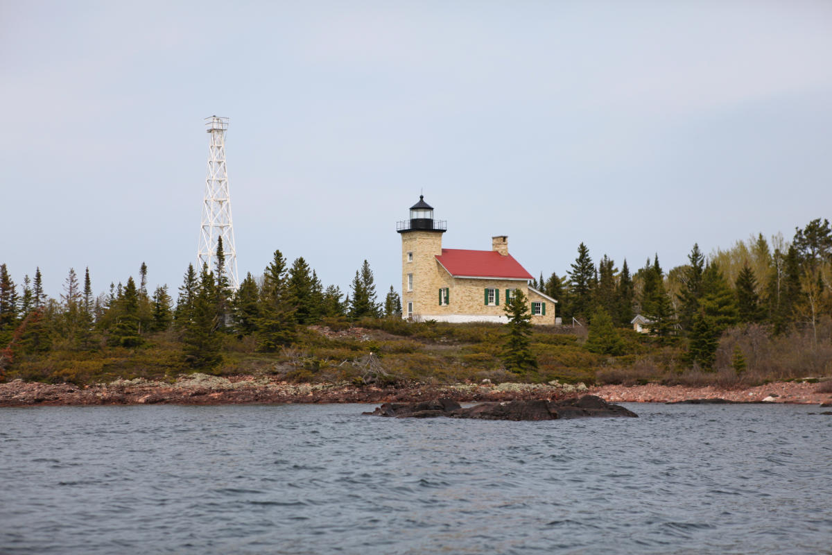
The Copper Harbor Lighthouse is located on Hays Point and is part of the Fort Wilkins Historic State Park.
Starting in 1856, a Frensel Lens was used. The light was converted from kerosene to acetylene gas in 1919, and a lighthouse keeper was no longer necessary to look after the light. In 1933, the gas light was moved to a sixty-foot steel tower nearby and was later converted to electricity in 1937.
Today, the Copper Harbor Lighthouse belongs to the State of Michigan and is part of Fort Wilkins Historic State Park. The lighthouse is not accessible by car, but it can be seen from the Copper Harbor Lighthouse Overlook or by taking a guided tour to Hays Point via boat. Currently, Noah’s Ark Charters is the only guided service operating tours to the lighthouse. Your captain will unlock the lighthouse and lightkeepers house so that you can view the historical museum exhibits set up inside. Stop by the Bella Vista Hotel or visit https://www.noahsarkchartersmi.com/ to learn more.
One Room Schoolhouse – 1850
Copper Harbor is bustling with energy during the summer months. Many folks return to the harbor year after year to enjoy summer at their family cabin or cottage. The number of residents who choose to brave the winter and live in Copper Harbor year-round remains much smaller. According to the most recent census, the year-round population of Copper Harbor is just 121 people. While the population may be small, Copper Harbor’s One-Room Schoolhouse still plays a key role in the education of village children.
Copper Harbor’s One-Room Schoolhouse was established and funded in 1850 by local copper mining families. At a time when highways didn’t exist, busing students to farther away schools simply wasn’t an option. The remote nature of the village and the severity of winter made the local schoolhouse a necessity for these families.
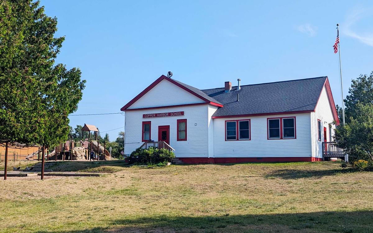
Copper Harbor One-Room Schoolhouse was established in 1850 by mining families living in the village at the time.
Since the schoolhouse first opened its doors, it has served students in first through eighth grades. Today, it also offers preschool and kindergarten classes. Older students are now bused from Copper Harbor to Calumet for their classes.
Copper Harbor’s cozy, little school is the oldest continuously operating one-room schoolhouse in Michigan and the farthest north! The school remains an important part of the community and will continue offering education as long as there are children to teach.
Clark Mine – 1853
Deep in the forest along dusty dirt roads, are hidden relics of the bygone era of copper mining in the Keweenaw. Clark Mine is one of them. Clark Mining Company started working on a small vein of copper here in 1853. The property went through different hands, but mining at this site continued periodically until 1901. This underground copper mine consisted of eight shafts and three adits. Today, all that is left is the towering chimney, stone formations that were once part of the company’s copper furnace, and mine tailing piles. The mine tailing piles include many different minerals, like prehnite, analcime, cuprite, copper, and datolite.
Getting to the mine is pretty easy. Take Manganese Road South (next to the Copper Harbor’s Visitor Center), through Fanny Hooe Campground, and past Manganese Falls. The road will turn into Clark Mine Road, and you should see a sign for the mine on the left. Please be advised that roads leading to the mine are unpaved. Always respect private property and explore old mine sites with caution.
The Community of Mandan – 1864
Once the site of the Mandan and Medora Mines, the community of Mandan is nothing more than a ghost town today. The two mines that operated at this site were organized in 1864 and worked intermittently until 1909 when they were completely abandoned. At one point, the community of Mandan had a few hundred residents, a few dozen houses, a general store, and a post office. It was also the last stop on the Keweenaw Central Railroad Line, which carried passengers from 1906 to 1918. The community of Mandan is about 12 miles south of Copper Harbor and can be accessed via the Mandan Loop off US-41. If you plan to take these unpaved backcountry roads, a good map is advised. Please remember that there is limited cell phone service in this area.
US-41 – 1926
US-41 serves as an essential state trunkline highway in the Upper Peninsula of Michigan and spans a total of 1,990 miles from Copper Harbor to Miami, Florida. While locals like to claim that this is where the highway begins, the cul-de-sac east of Fort Wilkins serves as the terminus between paved highway and dusty dirt road adventures.
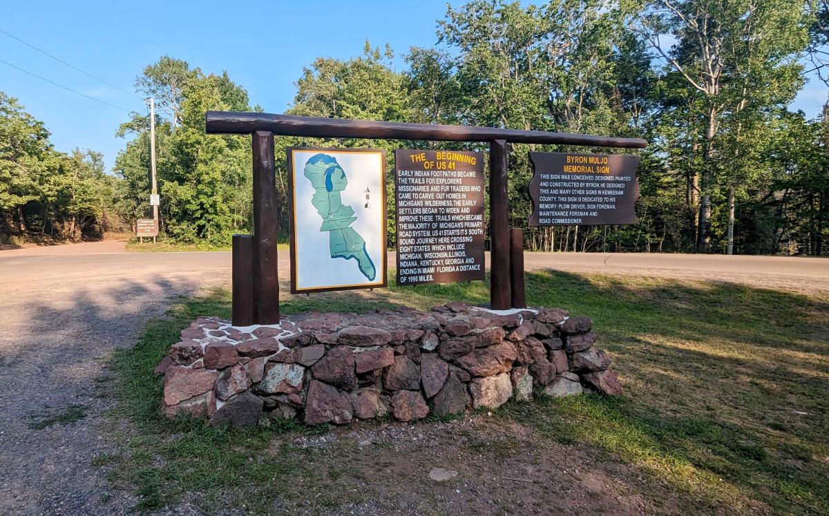
US-41 runs a total of 1,990 miles from Copper Harbor to Miami, Florida.
Before the construction of the highway in 1926, these routes were used by Native Americans, explorers, missionaries, traders, and miners traversing the region. The 47-mile stretch of US-41 from Houghton to Copper Harbor was designated a Michigan State Heritage Route in 1994, and later became known as the Copper Country Trail National Byway because of its historical significance. Make sure to take US-41 all the way to the end and grab a photo with the iconic wood sign that highlights this history.
Gateway to Isle Royale
Isle Royale is a remote archipelago located 56 miles offshore from Copper Harbor. Copper Harbor became known as the “Gateway to Isle Royale” in 1930 when the first ferry service started operating between Copper Harbor and the island. Isle Royale National Park was established on April 3, 1940, and was designated part of the National Wilderness Preservation System in 1976.
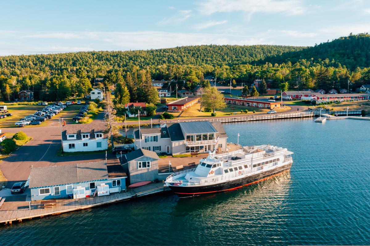
The Isle Royale Queen IV is the current ferry operating out of the Copper Harbor area.
Though Isle Royle itself had a rich history prior to becoming a National Park, it is now a destination for wilderness enthusiasts. Visitors can enjoy hiking, paddling, canoeing, camping, fishing, and pristine views of untouched wilderness. The Isle Royale Queen IV is the current ferry operating between Copper Harbor and Isle Royale, and it has been in service since 1971. Head down to the water between 6 and 6:30PM to snap a picture of the ferry as it returns to the Harbor. Or better yet, grab a table at the Harbor Haus and take in the views as you enjoy local fish or German/ Austrian cuisine.
Keweenaw Mountain Lodge – 1934
The Keweenaw Mountain Lodge was built during the Depression-era with financial assistance from the Federal Emergency Relief Administration under the leadership of President Roosevelt. At the time, the copper mining industry saw a quick decline and many families found themselves without work or the financial means to support themselves.
Keweenaw Copper Company donated 167 acres to the county with the condition that a 9-hole golf course would be constructed and open to the people of Keweenaw County. Construction included the clubhouse, which is now the Headquarters Building of the Keweenaw Mountain Lodge.
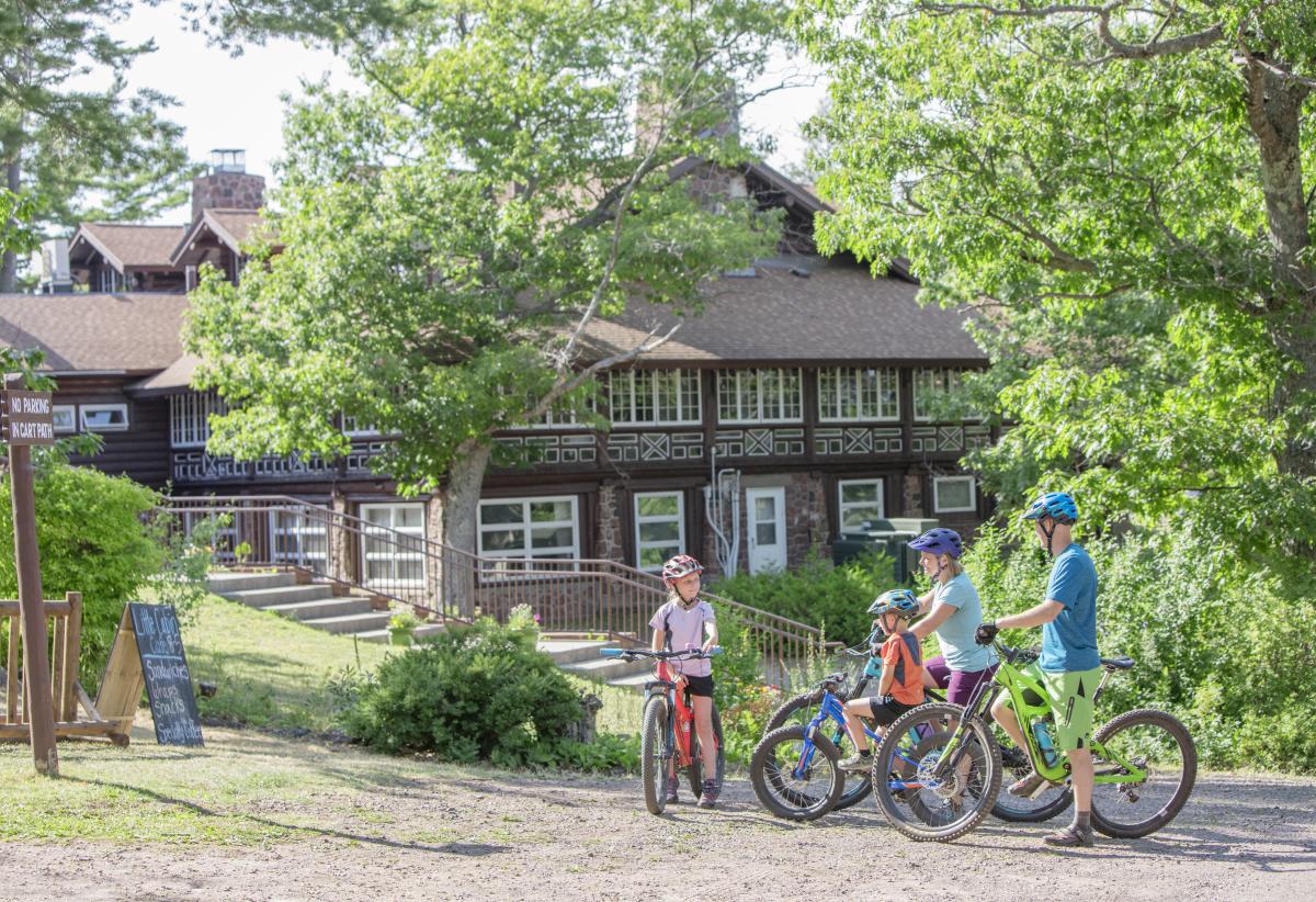
The historic Keweenaw Mountain Lodge offers lodging and outdoor recreation.
The cabins on the lodge property were constructed in 1935 under the Works Progress Administration program, with the assistance of a team of horses to haul logs and a crew of 124 men. The Lodge was listed on the State Register of Historic Places in 1976 and the National Register of Historic Places in 1980. Keweenaw County owned and operated the lodge until 2018, when it was sold to the Keweenaw Resort, LLC. Visitors can explore this history by taking a self-guided tour of the property or by staying in one of the historic log cabins.
Keweenaw Mountain Lodge also offers trails (open to the public) for outdoor recreation, a golf course, and is the headquarters of the Keweenaw Dark Sky Park. Outdoor recreational equipment is available for rent at their Outdoor Activity Center. You can also make a dinner reservation and enjoy rustic and worldly food in the historic lodge dining room.
Brockway Mountain Drive –1933
Named after Daniel D. Brockway, pioneer resident of the area, Brockway Mountain Drive is a must-see in the Copper Harbor area. This 8.8-mile-long scenic road offers panoramic views of Lake Superior, inland forests, and the historic village of Copper Harbor.
The road to the summit of Brockway Mountain was first proposed in the 1920’s by renowned landscape architect, Warren H. Manning, but construction wasn’t feasible until the federal funding under the Depression-era Road Projects was granted in 1933. The Depression-era Road projects were developed with hopes of creating work for families in need, and the Keweenaw County Road Commission received funding to participate in the program. The Road Commission’s plan was to build local roads, Brockway Mountain Drive, and what was known as the Keweenaw Park & Golf Course Project (now known as Keweenaw Mountain Lodge).
Brockway Mountain Drive was constructed using manual labor and a team of horses, maximizing the number of men to be employed. All grading and leveling of the road were done by hand, as well as the stone walls which were constructed in 1934.
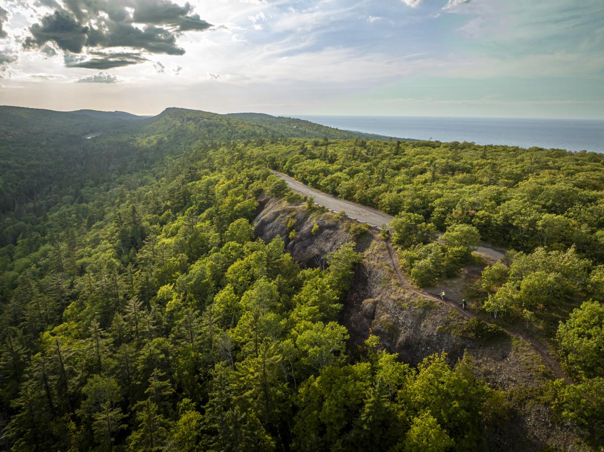
Brockway Mountain Drive was constructed in 1933 as part of the Depression-era Work Programs.
For many years, the Wescoat family operated a small gift shop at the summit of Brockway called the Skytop Inn. The original Skytop was a small log cabin with a wraparound porch that allowed visitors to take in the panoramic views around them. This structure was later replaced with a more modern structure in 1960's and continued to operate as a gift store until it was purchased by Eagle Harbor Township in 2013. This purchase of the Skytop Inn was supported by the countless donations, support of the Westcoast family, and through collaboration of community-minded organizations to ensure that the summit of Brockway Mountain would remain protected and unimpeded by later development.
Following the purchase of the Skytop Inn, the summit was dedicated as part of the Keweenaw Coastal Wildlife Corridor. The Brockway Mountain Hawk Watch is now conducted each spring (between March 15 and June 15) to track the migration of birds passing through this flight path. According to the Copper Country Audubon, spring counts have recorded up to 25,000 raptors during this time. So, grab your binoculars and head to the top of Brockway Mountain Drive to take in the incredible views, raptors by the dozens, and the historic landscape of the region.
Keweenaw Rocket Range – 1964
Copper Harbor area is also home to the site of the former Keweenaw Rocket Range. This site was used by NASA from 1964 to 1971 for launching rockets to collect meteorological data. Rockets sent from this site collected data about electron density, solar X-rays, energetic electron precipitation, and other scientific measurements. Michigan’s first rocket to enter space was launched from this site on January 29, 1971. Today a commemorative plaque is all that remains of the abandoned launch site. Visitors who are interested in reaching this site can take the Rocket Range Spur Trail off High Rock Bay Road. Be advised that this trail can be extremely rough and getting to the site can take a considerable amount of time.
Estivant Pines – 1973
Although the Keweenaw Peninsula is better-known for its mining history, the timber industry has historically had a strong presence in the region. During the mining-era, timber was used in mine shafts for structural support and in the craftmanship of buildings constructed in our small towns. Today, the industry continues to prosper, and you are likely to see a logging truck or two on your next trip to the Keweenaw. The companies working in our area today use sustainable practices like selective harvest to ensure that our forests remain healthy for future generations.
Estivant Pines is one of the many nature areas in the Keweenaw Peninsula that has been protected from future forestry operations. This Michigan Nature Association Nature Sanctuary is special because it protects one of the last old-growth white pine stands in Michigan and is home to trees that are over 300 years old.
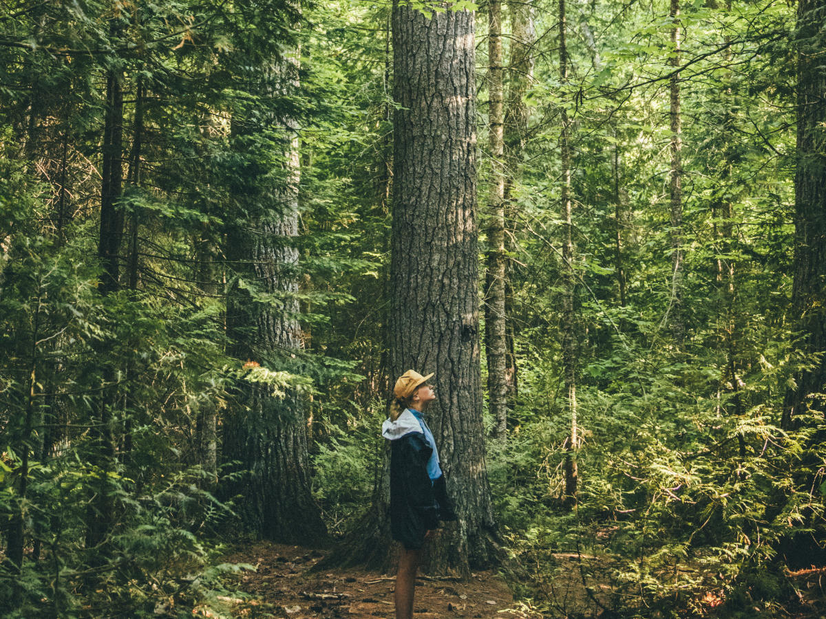
Estivant Pines Nature Sanctuary is home to towering trees as old as 300+ years.
The land was originally owned by Edward Estivant of Paris, who sold it to Calumet & Hecla Mining Company in 1947. In 1968, Calumet & Hecla Mining Company closed their last mines and sold the tract of land to Universal Oil who had plans to begin future logging in the area. Michigan Nature Association jumped onboard in 1973 and began a fundraising campaign to purchase 200 acres of the land. Concerned local citizens formed the “Save the Pines” committee and helped fundraise for this initial land acquisition. Three additional land acquisitions in later years expanded the sanctuary to 570.5 acres.
Two loop trails bring visitors through towering pines and groves of maple and oak, intersecting to form a 2.5-mile hike. Keep your eyes (and ears) open for birds and other critters. It is estimated that more than 85 bird species inhabit the forest, including woodpeckers, hawks, and red crossbills.
Outdoor Recreation
Present day Copper Harbor thrives thanks to its vast wilderness and recreational opportunities. The quaint small town is a hopping off point for endless outdoor activities, such as mountain biking, hiking, kayaking, or off-roading. During the winter, it’s a popular destination for snowmobile enthusiasts, skiers, or those who enjoy snowshoeing.

Copper Harbor is a peaceful wilderness destination that offers a variety of recreational activities suitable for all skill levels.
While the local brewery may be bustling with energy on a warm summer day, it’s easy to adventure into the surrounding wilderness and hear nothing but the melody of songbirds high above you in a tree. Copper Harbor is a peaceful place and its rich history, recreational activities, and location at the tip of the Keweenaw Peninsula inspire many visitors to return year after year. We encourage you to explore the places we love responsibly so that they may be enjoyed by all the future generations to come. Find lodging in the Copper Harbor area here.

Interested in updates, travel tips and quirky information about the Keweenaw? Just sign up for the Keweenaw Explorer, our monthly e-newsletter. Complete the form…