The Keweenaw Peninsula is well known for its rugged and natural beauty. The region features variable topography and long winding rivers that spit into Lake Superior. These features combine with the Keweenaw’s unique geology to create the perfect setting for some of the most beautiful waterfalls and deepest gorges in the Upper Peninsula of Michigan. Pack your car and get ready to enjoy our scenic Keweenaw waterfall driving tour. Explore our favorite waterfalls and enjoy historic sites, nature hikes, and Lake Superior sunsets along the way.
Best Time to View Waterfalls
While our regional waterfalls are a treat to visit during any season, we highly recommend planning a waterfall trip during the spring. The Keweenaw receives quite a bit of snow during the winter months. During the spring, all that snow melts rapidly, recharging our rivers and streams. From as early as mid-March to late April, our waterfalls roar to life thanks to the increased volume of water in our rivers during the spring thaw.
Day 1: Getting Here
Michigan’s Upper Peninsula is home to over 300 waterfalls. If you are driving to the Keweenaw, chances are there are a few waterfalls to experience along the way.
Canyon Falls
For those entering the Keweenaw Peninsula via US-41, stop by Canyon Falls Roadside Park to stretch your legs. Located 7 miles south of L’Anse, the Canyon Falls is an impressive and easy-to-visit falls. Follow the scenic trail along the Sturgeon River to a series of rapids and small waterfalls, leading to the main waterfall and box canyon. Often referred to as the “Grand Canyon” of Michigan’s Upper Peninsula, the river has created a deep gorge through the slate rock. Set aside 1-2 hours to explore the down and back trail at Canyon Falls. The trail is well-maintained and easy to traverse but watch out for tree roots and rocks.
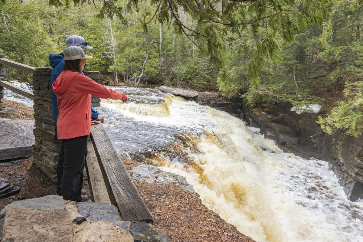 Canyon Falls Roadside Park is the perfect spot to stretch your legs before arriving to Houghton.
Bond Falls
If you are driving to the Keweenaw through Bruce Crossing on US-45, we recommend taking a small detour to stop at Bond Falls. The falls are located along the middle branch of the Ontonagon River, where water tumbles over a thick band of fractured rock, creating many small cascades. The total drop of the falls is about fifty feet. The park typically opens for vehicular access in mid-May but can be accessed via the hiking trail year-round.
Sturgeon River Falls Gorge
The Sturgeon River Falls is located in southern Houghton County and is a paradise for adventure seekers. Visitors will find a small parking area and trailhead located off of Forest Road 2270 (just North of the town of Sidnaw). Please note, that the forest service roads used to access the trailhead are not plowed during the winter. We recommend waiting until after the snow has melted to traverse these roads.
The trail to the waterfall is about a mile in length, dropping a few hundred feet as you descend the steep gorge to the river below. The waterfall at the gorge is impressive, funneling the entire Sturgeon River into a tight rocky chasm. Be careful on the final part of the trail, as it can be slippery. Plan for about 2-3 hours to enjoy this wilderness area. For a complete guide on visiting the Sturgeon River Gorge Wilderness Area, see our guide by local explorer, Nathan Invincible Miller.
Wyandotte Falls
Just off M-26 near Twin Lakes State Park, you will find Wyandotte Falls. This is one of those waterfalls that can dry up to a trickle during the summer months, so it is best to stop here during the spring runoff. Just a short walk from the parking area, water trickles over moss covered rocks along the Misery River. Relax and enjoy this quiet nature area just before entering Houghton.
Crossing the Portage Lake Lift Bridge: A Scenic Drive to Hungarian Falls
The Portage Lake Lift Bridge connects the small towns of Houghton and Hancock and is often referred to as the “Gateway to the Keweenaw.” For your waterfall tour, we advise you to stay in the right lane, taking the M-26 turn toward Lake Linden.
This is a scenic drive that runs parallel to the Portage Canal for many miles, passing through the small towns and communities of Ripley, Dollar Bay, Mason, Tamarack, and Hubbell. Views of the canal will continue until you reach Dollar Bay.
Pro Tip: At this point, we want to mention that we are on our way to a waterfall hike. We recommend stopping by Quincy Dining Co. on the right side of M-26 in Dollar Bay to fuel up before the hike! Quincy’s offers a nice selection of soups, sandwiches, pizzas, and dinners in a family-friendly atmosphere. This unique restaurant also features historic memorabilia related to the Keweenaw’s mining history and Upper Peninsula culture.
Once you pass Dollar Bay, be sure to look for small trickling “waterfalls” coming from the woods on the left side of the road. These “waterfalls” are only seen during the spring or after a large rainfall. Beyond unnamed, miniature roadside waterfalls, there are many other interesting sights to see along the way.
Just east of Mason, you will see the remains of the Quincy Dredge No. 2 sunken in the shallow waters of Torch Lake. Constructed in 1914 by the Calumet & Hecla Mining Company, this dredge was used to reclaim previously milled sand that was deposited in the lake after it went through the stamp mill. It was designated as a Michigan Historic Site in 1978 and remains a significant landmark along this scenic route. Across from “The Dredge” are remnants of the Quincy Mining Company Stamp Mill.
As you enter Tamarack Location be on the lookout for another historic site, the Ahmeek Stamp Mill Ruins. These ruins can be seen on the right side of the M-26 next to the Tamarack City Park and are a worthy photo-op on your way to our waterfall hike.
Hungarian Falls
Okay, we are getting close to our first Keweenaw waterfall hike! Slow down just after the Stamp Mill Ruins and keep your eyes peeled for 6th St. Take a left on 6th St and drive up the hill, where the road will turn into gravel. About half a mile after your initial turn on 6th St., you will see two metal posts in the ground where the trailhead starts on the left side of the road. There is no parking area, but you are welcome to park along the side of the road.
Breathe in the earthy smell of Keweenaw forest as you follow the trail leading back to Hungarian Falls. Where the trail splits, you can either take a right and hike past the historic dam and retention pond to the Upper Falls or take a left down the gorge to explore Middle and Lower Falls. We personally recommend doing both! Each drop along this gorge offers different, yet equally incredible views. The entire hike up and down the gorge is roughly 2 miles, but please remember that this is a rustic hiking and nature area. While the trail itself is relatively easy to traverse, the rugged geology creates many steep cliffs and drop offs where careful footing is advised.
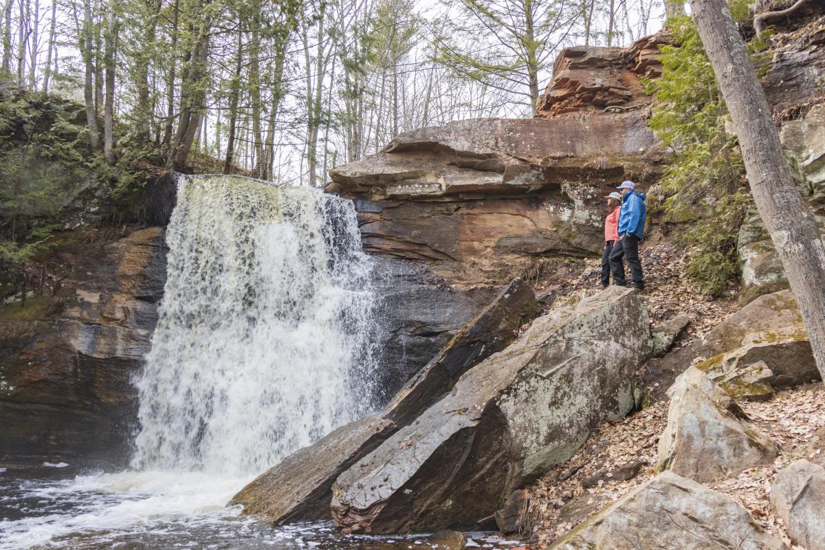
Hungarian Falls features several drops and viewing points.
Responsible Recreation at Hungarian Falls
The Hungarian Falls Nature Area is a Keweenaw Land Trust (KLT) property that is open to the public year-round. Please follow these few tips and rules to help keep this beautiful destination (and other destinations like it) pristine and accessible for generations to come.
-
Dogs are allowed at this KLT property, but please keep your pups leashed and bring waste-bags to clean up after them.
-
Pack out what you pack in. Keep Hungarian Falls pristine by packing out your trash and picking up any litter that you may see.
-
Respect plants and wildlife. Travel along durable surfaces and defined trails. Avoid small “goat paths” that may harm plants or cause erosion.
-
Stay on KLT property. Don’t trespass on surrounding land.
-
Learn about the 7 Principles of Leave No Trace and practice responsible recreation while you are visiting the Keweenaw Peninsula.
Heading into Calumet Area
After enjoying the sights and sounds of Hungarian Falls, it’s time to hop back in the car. Turn around and head back down the hill the same way you came, taking a left on M-26 towards Lake Linden. Lake Linden is a charming small town along Torch Lake and offers beautiful parks, churches, and dining options. Take a moment to appreciate the history of this quaint small town, then follow the signs for M-26, taking a hard left towards the end of town.
Continue along M-26 for about 4 miles to Calumet. At this point, you’ve reached the Visit Keweenaw Welcome Center! If you are traveling through during business hours, stop in and say “Hi.” Our Welcome Center also offers a 24-hour lobby with access to maps and information about the area at any time of day.
Gardners Creek & Calumet Waterworks Park
After saying "hey" to our friendly staff, continue on US-41 to the north end of town, taking the turn for the M-203 towards Calumet Waterworks Road. As you head down the long hill on Calumet Waterworks Road, you will see Lake Superior on the horizon. At the bottom of the hill, you will find the trailhead for Gardeners Creek Trail. While this trail doesn’t take you to a waterfall, it does take you through a beautiful forest and along Gardeners Creek.
This creek is best to explore during the spring snow melt (when it flows rapidly) because it often dries up completely by summer. Be on the lookout for wildlife as you follow the babbling creek through the forest on this short hike.
Pro Tip: We recommend packing some rubber boots to explore this trail, as the creek makes diversions across the trail and through the woods as it flows downhill to Lake Superior during the spring melt.
After your hike, we suggest heading into the park to enjoy Lake Superior. Calumet Waterworks Park is a popular destination for rock-picking and is the ideal spot to catch a Lake Superior sunset. If you head south on the beach, you will even find the confluence of Lake Superior and Gardners Creek. Enjoy a relaxing sunset at Calumet Waterworks Park before heading back into the town of Calumet to wind down for the evening with dinner and drinks.
Day 2: Scenic Waterfall Drive to Copper Harbor
Fuel up with a cup of coffee and a big breakfast because we have a full day planned for you. Your day 2 scenic drive will take you through Keweenaw forest, past ancient cliff ridges, and to several waterfalls as you make your way to Copper Harbor.
Start your drive along US-41N through the communities of Kearsarge, Allouez, Ahmeek, and Mohawk as you make your way to the intersection of M-26 and US-41 in Phoenix.
Pro Tip: Grab a pasty or snacks at the Mohawk Superette on your way! This way you’ll be prepared for a picnic lunch at one of the scenic destinations along the way. Of course, if you plan on having a picnic, make sure to throw away any trash in a proper garbage can!
Upper Eagle River Falls (A.K.A 10” Falls)
On this waterfall-seeking adventure we are going to take the left towards Eagle River on M-26. Just shy of a mile past this turn, you will see a gravel pull off on the right side of the road. While there is no sign or markers indicating anything spectacular, we encourage you to stop and enjoy what locals call “10-foot falls,” or Upper Eagle River Falls. During the winter, this section of the river slows to a trickle as snow packs the riverbed. In the spring, the river widens as all the snow rapidly melts. Enjoy the sound of water as it rushes over giant basalt boulders and flows downriver to Lower Eagle River Falls.
Lower Eagle River Falls
After capturing a few photos at this hidden little spot, continue the short drive into Eagle River. As you enter Eagle River, you will cross over a bridge on the highway. There will be a parking area to the right of the bridge. From here, you can walk out onto the steel pedestrian bridge to view the Lower Eagle River Falls from the top down. The falls is on the site of the original Lake Superior Fuse Company and remains of the dam still span most of the 60-foot-wide river. The dam extends the falls to a total height of well over 60 feet.. A spectacular sight indeed!
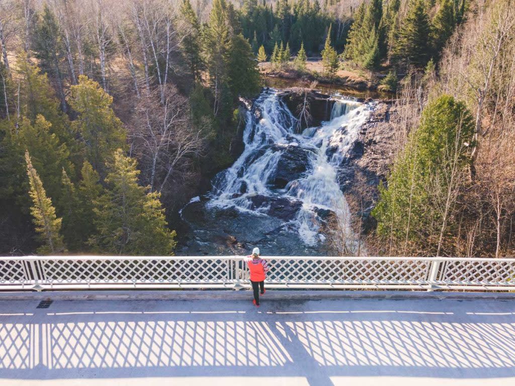
A steel pedestrian bridge offers views of Lower Eagle River Falls.
While the Lower Eagle River Falls is a sight to behold, don’t forget to turn around and admire the craftsmanship of the M-26 Timber Bridge (the one you just drove over)! Built in 1991, this bridge was designed to carry the same traffic loads as our state trunkline concrete and steel bridges. Two side-by-side arches spanning 74 and 79 feet serve as the main supports of this unique bridge. Not to mention, the deep gorge and river below create the perfect backdrop for beautiful photos of the timber bridge.
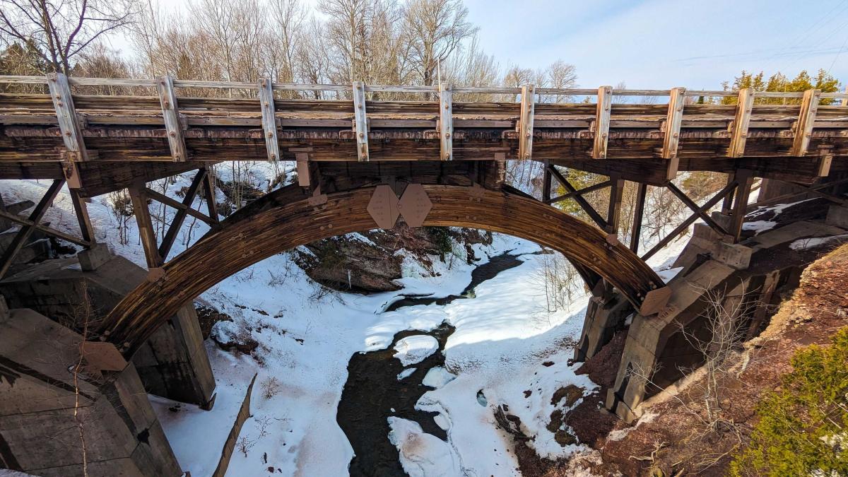 The M-26 Timber Bridge can also be seen from the Lower Eagle River Falls pedestrian bridge.
Before heading to the next waterfall on our list, follow Main St. down to the Eagle River Beach. This public beach offers breathtaking views of Lake Superior and is the perfect spot to hunt for prized beach stones. The beach is also home to The Fitzgeralds Restaurant & Hotel. Book a stay here and listen as Lake Superior waves lull you to sleep or make a dinner reservation and enjoy sunset views while eating the best hardwood smoked barbeque in the Upper Peninsula.
Jacob’s Falls
Continue on M-26 for approximately 3 miles, and you will come across one of our favorite roadside waterfalls, Jacob’s Falls! When we say “roadside”... we mean you can literally see this one from your car as you drive by! Of course, we certainly recommend getting out of your car to fully appreciate the beauty of Jacob’s Falls. The main section of the falls near the road falls about 20 feet over rough basalt rock. Another section of the falls is located further up the gorge. Trails run up the side of the steep rock into the woods upstream, but it can be a tricky climb.
At this point, we need to mention The Jampot. The Jampot is a small, seasonal bakery right next to Jacob’s Falls. It is run by Monks of the Holy Protection Monastery, a Byzantine Catholic Monastery, which can be seen right down the road. The Jampot doesn't usually open until late April, but goods can be purchased year-round on their online store.
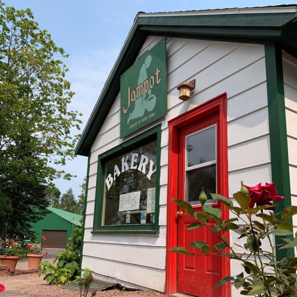
The Jampot is a small seasonal bakery located right next to Jacob's Falls.
The Monks also maintain a beautiful trail system that takes you along a scenic hike to the Arnold Mine Ruins and along Jacob’s Creek and the gorge that creates Jacob’s Falls. This hike can be accessed on Eagle Harbor Cutoff Road and may make a fantastic adventure for another day.
Silver River Falls
Enjoy 9 miles of coastal views on your way to our next destination, Silver River Falls. Feel free to stop at Great Sand Bay for a picnic or snap some photos of Eagle Harbor Lighthouse along the way! There is a parking area on the right side of the road at the Silver River Bridge, but you will need to cross the road to access the trailhead.
The Falls begin a short walk downstream from the bridge, where the stream divides to drop about 7 feet over a rock outcropping, then continues as rapids to another small pool.
If you're up for a scenic detour, we highly recommend taking Brockway Mountain Drive. This 9.5 mile drive takes you to the top of Brockway Mountain, where you will be treated to panoramic views of Lake Superior, inland lakes, and vast Keweenaw forest. The mountain is also an excellent spot for watching the spring bird migration. Although, we want to remind you that this road is a seasonal road and won't open until mid to late spring when the snow melts.
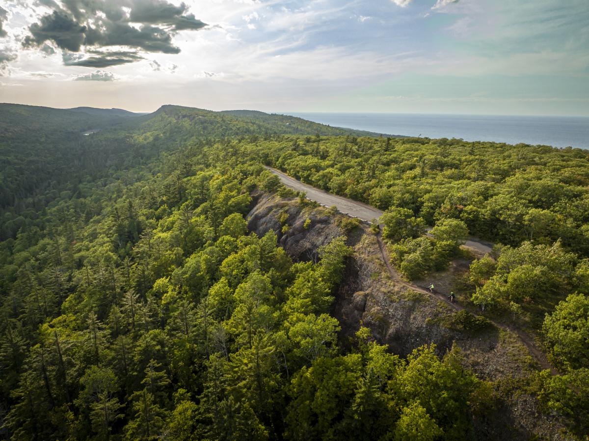
Brockway Mountain Drive is a scenic drive into Copper Harbor that offers panoramic views of Lake Superior and Keweenaw forest.
Manganese Falls
Once you've made it into Copper Harbor, we encourage you to check out Manganese Falls. Manganese Falls is just a short walk on a trail near Lake Fanny Hooe. This down-and-back hike takes you along the top of a deep gorge to a viewing area at the end of the trail. Water drops at least 45 feet from the top of the rocky gorge past sheer moss-covered walls. This one is a hidden treasure that comes to life in the spring.
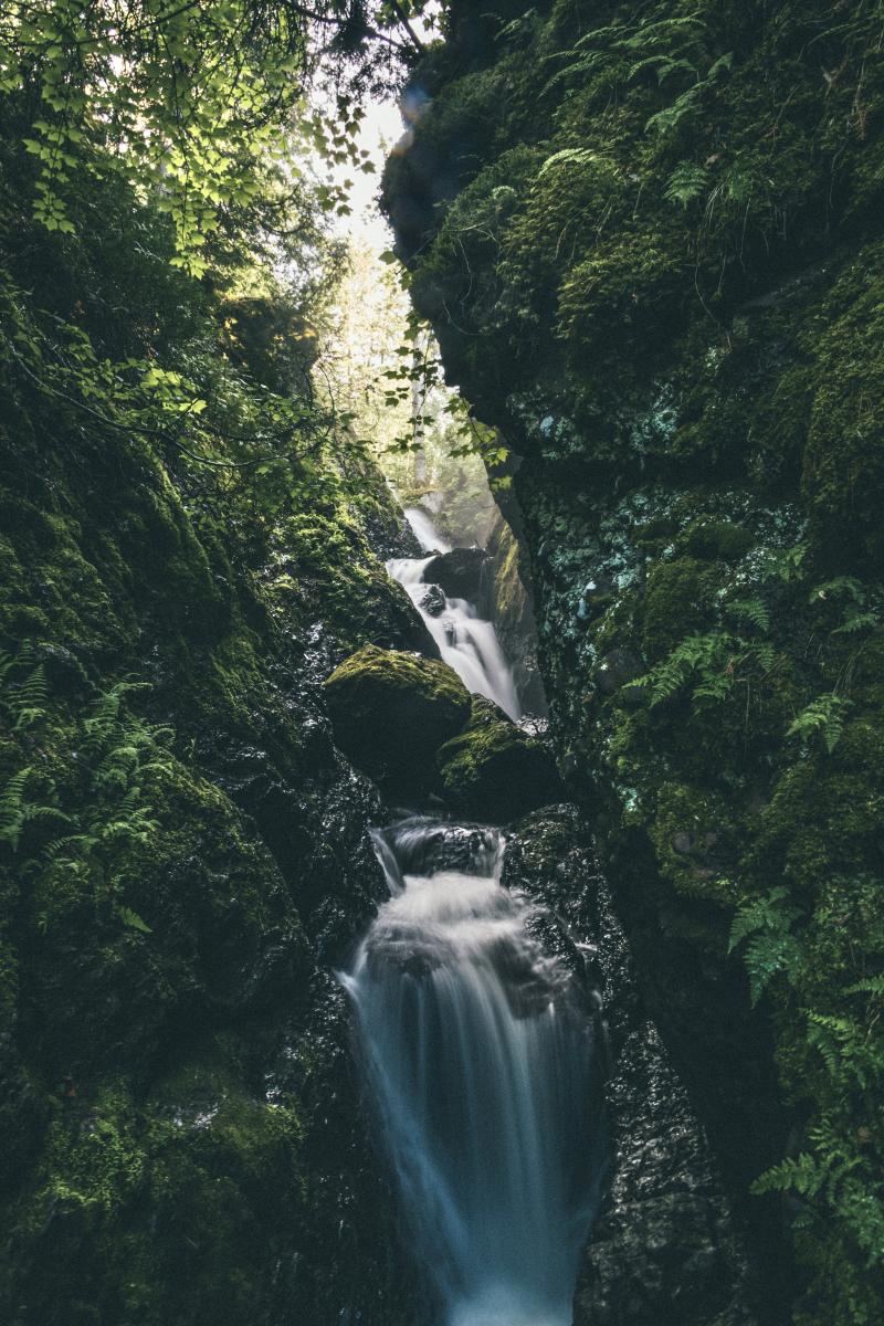
Manganese Waterfall falls through a deep moss covered gorge in Copper Harbor.
From incredible views of Lake Superior to Fort Wilkins Historic State Park, make sure to spend some time exploring Michigan’s northernmost town. This quaint small town also offers a variety of dining options. Enjoy German flavors and Lake Superior views at the Harbor Haus (open seasonally) or a delicious pizza and burgers at the Mariner North -it's up to you!
When you're ready to bid farewell to Copper Harbor, take US-41 out of town. This section of road is one of the most scenic drives in the Keweenaw, taking you past Lake Medora before entering the "tunnel of trees." The trees are so close to the roadway that they literally form a canopy of leaves above the road as you drive.
Haven Falls
After making it out of the "tunnel of trees," be on the lookout for Lac La Belle Road on the left side of the road. This road will take you into the community of Lac La Belle, where we will conclude our tour with Haven Falls. This roadside waterfall features a steep drop over rough conglomerate rock, with several smaller drops upstream. During the spring, a foaming curtain of water falls over the steep rock before slowing to a trickle in the summer.
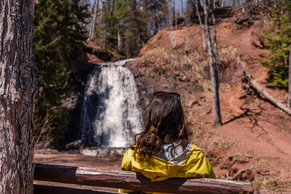 Haven Falls is another easy-to-access roadside waterfall.
Bonus "Falls"
If you have some extra time in the area, we encourage you to check out the Keweenaw's largest man-made waterfall at Redridge Dam. This historic site is located on the western side of the Keweenaw near Freda, MI (a little out of the way to be included in our tour).
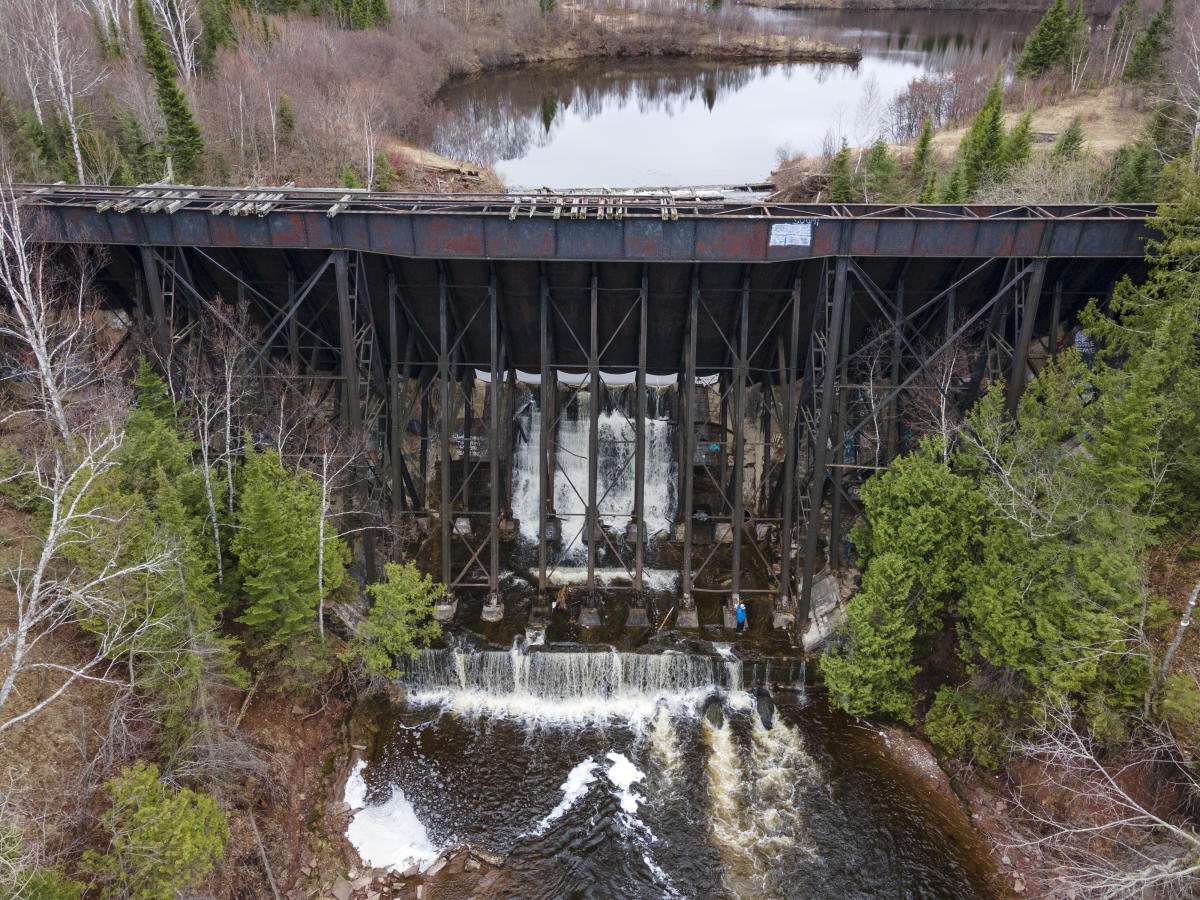
The Redridge Dam creates a manmade waterfall on the Salmon Trout River near the ghost town of Freda.
Redridge Dam is just a short hike from the parking lot through a steel dam constructed in 1901 on the Salmon Trout River. Visiting the Redridge Dam and the nearby ghost town of Freda can make an excellent afternoon trip from Houghton.
Interested in updates, travel tips and quirky information about the Keweenaw? Just sign up for the Keweenaw Explorer, our monthly e-newsletter. Complete the form…

